
As an Amazon Associate, I earn from qualifying purchases.
In this article 8 sections
When a storm is out there, everyone asks the same two questions: where is it now, and where is it going? The good news is that the official answers are free, updated around the clock and easier to read than they look. This page cannot show you today's storm (by the time you read it, the map has moved on), but it shows you exactly where to look for each ocean, how often the information updates, and how to read the famous "cone".
Short answer: for storms in the Atlantic and eastern Pacific, go to the National Hurricane Center at hurricanes.gov. For the central Pacific around Hawaii, the Central Pacific Hurricane Center at weather.gov/cphc. For Guam and the Northern Mariana Islands, the National Weather Service office in Guam. When a storm is active, the NHC and CPHC update their advisories at least every 6 hours, and every 3 hours once coastal watches or warnings are up (NWS).
Editorial Research
- Written by
- Lena Thornton, Weather Station Analyst & CWOP Contributor
- Based on
- The National Weather Service page on hurricane watches, warnings, advisories and outlooks, the National Hurricane Center's page on the forecast cone, NOAA's Hurricane Research Division FAQ, the Japan Meteorological Agency's RSMC Tokyo Typhoon Center, Ready.gov, and Midland's product page and owner's manual for the ER40
- Hands-on testing
- Not performed by The-Weather.com for the radio on this page
- Research last verified
- October 20, 2026
The Official Trackers, Ocean by Ocean
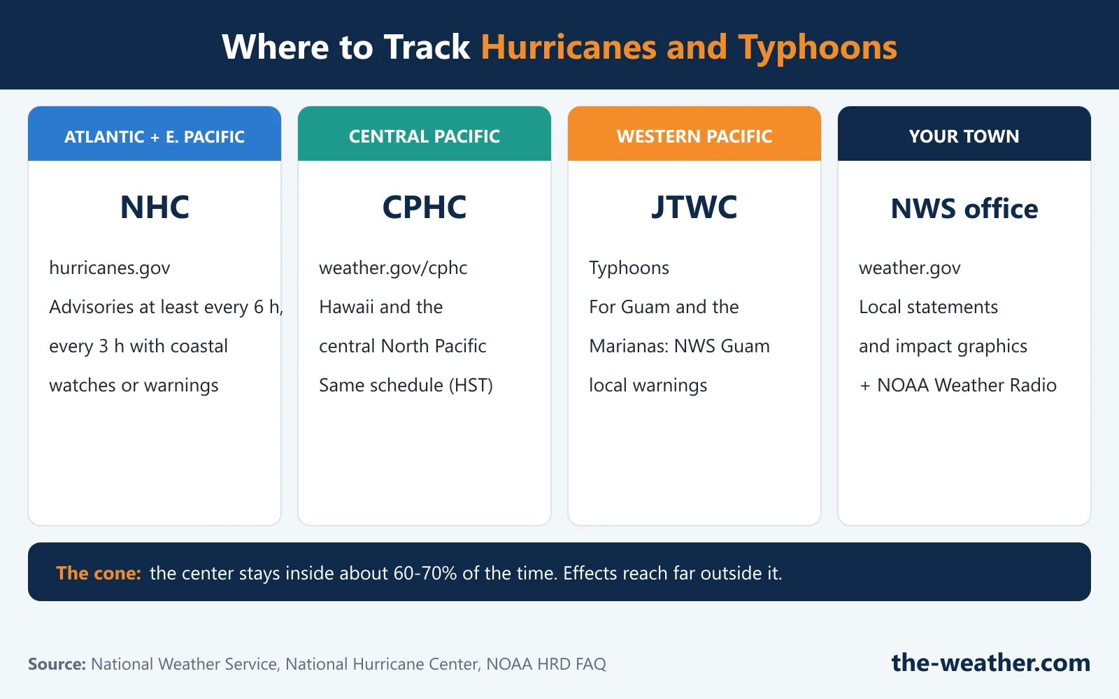
| If the storm is in... | Official tracker | Good to know |
|---|---|---|
| Atlantic, Caribbean, Gulf, eastern North Pacific | National Hurricane Center: hurricanes.gov | Advisories at 5 am, 11 am, 5 pm and 11 pm Eastern time, plus updates every 3 hours with coastal watches or warnings |
| Central North Pacific (Hawaii) | Central Pacific Hurricane Center: weather.gov/cphc | Same schedule in Hawaii time |
| Western North Pacific (typhoons) | To follow the storm: the Japan Meteorological Agency's RSMC Tokyo Typhoon Center, the regional center for the western North Pacific, or the U.S. Joint Typhoon Warning Center. For official warnings: your own country's weather service, such as PAGASA in the Philippines, JMA in Japan, CWA in Taiwan and the NWS office in Guam for Guam and the Marianas | JMA says its regional typhoon information is not the official warning for each area; that comes from the national weather service of each country |
| Your own town, anywhere in the U.S. | Your local NWS office via weather.gov | Local offices issue Hurricane Local Statements and threat and impact graphics for your area |
Schedules and products: National Weather Service. JTWC history: NOAA HRD FAQ. Western Pacific: JMA RSMC Tokyo.
Not sure which ocean a storm is in, or why one is a hurricane and the other a typhoon? Our main page What Is a Typhoon? explains the three names.
"Is There a Hurricane Right Now?"
The National Hurricane Center publishes its outlooks and advisories for the Atlantic and eastern Pacific at hurricanes.gov. Two products answer the "is something coming?" question:
- Tropical Weather Outlook: areas of disturbed weather and their chance of becoming a tropical cyclone in the next 48 hours and in the next 7 days, also as a map (see the NHC outlook page).
- Tropical Cyclone Public Advisory: for an existing storm, its position, maximum sustained winds, current motion, all coastal watches and warnings, and the hazards it brings.
Both are described on the NWS watches and warnings page. The Atlantic season officially runs from June 1 to November 30 and the eastern Pacific season from May 15 to November 30, but NOAA notes that Atlantic hurricanes have occurred outside the official season (NOAA HRD FAQ). In the western Pacific, typhoons can happen in any month; see our typhoon season page.
How to Read the Forecast Cone
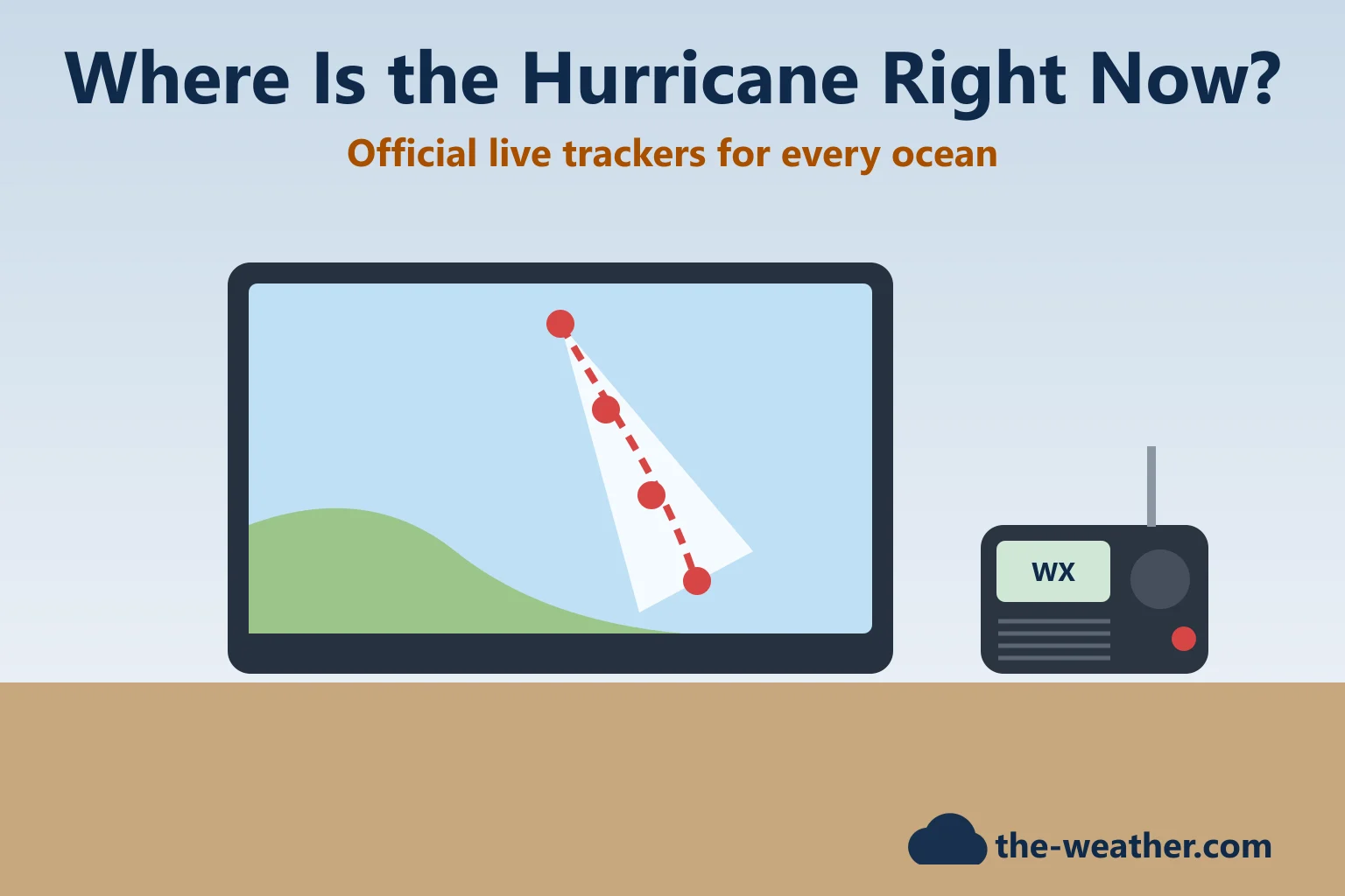
The "cone of uncertainty" is the most shared hurricane picture, and the most misunderstood. What it does and does not mean:
- It shows the probable track of the storm's center only. The NHC builds it from circles along the forecast track, sized so that two-thirds of its past forecast errors (over the last five years) fall inside them (NHC).
- The center stays inside the cone about 60 to 70 percent of the time, according to the NWS. So roughly one time in three, it does not.
- Outside the cone is not safe by definition. The NWS warns that a storm's effects can span hundreds of miles, and areas well outside the cone often get tornadoes or inland flooding from heavy rain.
In our view, the best way to use the cone is as a heads-up for the next few days, and then to act on your local watches and warnings, not on whether you are inside a line on a map.
Radar, Satellite and Apps
Once a storm gets close to land, radar shows the rain bands coming in. Our guides where to find live weather radar and how to read weather radar help with that part. For alerts on your phone, Ready.gov suggests the FEMA app, which can send National Weather Service alerts for up to five locations, and reminds you that Wireless Emergency Alerts need no sign-up (Ready.gov).
One tip for any weather screenshot: check the time stamp and the source. An old or unofficial map shared on social media can be many hours behind the latest advisory.
Tracking When the Power and Internet Are Down
This is where most tracking plans break. A storm can knock out power and drain your phone. Ready.gov advises charging devices and getting backup batteries in case power outages continue. The NWS lists NOAA Weather Radio as one of the ways its hurricane advisories reach the public, and Ready.gov's evacuation advice includes listening to a battery-powered radio and following local instructions. A crank or solar weather radio keeps that channel open when the outlets and chargers do not work.
One option for a go-bag is the Midland ER40, based on Midland's own specifications: NOAA weather alerts on 7 weather channels, AM/FM, a hand crank and a solar panel for its rechargeable 2,600 mAh battery, a flashlight with SOS strobe and a USB port to top up your phone. Its manual says it receives NOAA broadcasts up to about 50 miles from the transmitter, depending on terrain and conditions, and that it can sound an alert while switched off if alerts are turned on. One honest limit: Midland's manual and spec sheet do not mention SAME county filtering. We have not tested it ourselves; the full details are in our Midland ER40 review.
Keep tracking when the grid goes down
Midland ER40 crank and solar NOAA weather radioon Amazon · opens in a new tabAffiliate link: we may earn a commission if you buy through it, at no extra cost to you. More choices in our weather radios for hurricane season page. Gulf Coast? Find your NOAA frequency in our Gulf Coast NOAA frequencies and SAME codes list.
Hurricane Tracking FAQ
Where can I see where the hurricane is right now?
On the National Hurricane Center's site, hurricanes.gov, for the Atlantic and eastern Pacific; on weather.gov/cphc for the central Pacific around Hawaii; and through the NWS office in Guam for Guam and the Northern Mariana Islands. Your local NWS office at weather.gov adds the local details.
How often is the hurricane forecast updated?
The NHC and the Central Pacific Hurricane Center issue advisories at least every 6 hours (at 5 am, 11 am, 5 pm and 11 pm: Eastern time for the NHC, Hawaii time for the CPHC), and public advisories every 3 hours when coastal watches or warnings are in effect.
Which way is the hurricane headed?
Check the latest public advisory: it gives the storm's current motion, and the cone graphic shows its predicted track. The cone on the map shows where the center is likely to go, and the NWS says the center stays inside it about 60 to 70 percent of the time.
Am I safe if I am outside the cone?
Not automatically. The NWS warns that a tropical cyclone's effects can span hundreds of miles and that areas well outside the cone often see tornadoes or inland flooding. Follow your local watches and warnings.
How do I get hurricane alerts without internet?
Use a NOAA Weather Radio with batteries, a hand crank or solar charging. The NWS broadcasts its watches, warnings and advisories on NOAA Weather Radio, and Ready.gov advises listening to a battery-powered radio during an evacuation.
Update Log
- October 20, 2026: First version. Advisory schedule from the NWS, cone details from the NHC, outlook horizon from the live NHC outlook page.
Sources
- National Weather Service: Hurricane and Tropical Storm Watches, Warnings, Advisories and Outlooks
- National Hurricane Center: Definition of the NHC Track Forecast Cone
- National Hurricane Center: Tropical Weather Outlook (48-hour and 7-day formation chances)
- NOAA Hurricane Research Division: Tropical Cyclone FAQ
- Japan Meteorological Agency: RSMC Tokyo Typhoon Center (role of its regional information)
- Ready.gov: Hurricanes and Ready.gov: Evacuation
- Midland ER40: product page and owner's manual
More in this series: What is a typhoon? · Watch vs warning · Storm surge · Evacuation zones · Hurricanes in the Pacific