
As an Amazon Associate, I earn from qualifying purchases.
In this article 5 sections
Why NOAA's Weather Data Is Important: The Science Behind Every Forecast
Every weather forecast you check, every storm warning on your phone, and every NOAA alert radio broadcast that wakes you at night traces back to one source: NOAA's weather data collection network. NOAA data is the foundation of the most accurate weather forecasts available today. Compared to private weather apps, NOAA provides the raw data that all forecasts are built on. Understanding why this data matters, how it is collected, and who depends on it changes how you think about every weather report.
Six Reasons NOAA's Weather Data Is Critical
NOAA's data does not just power weather apps, it underpins public safety, the economy, and scientific research at a national scale
It Powers Every Weather Forecast in America
Every forecast on every weather app, website, and TV broadcast starts with NOAA numerical weather prediction models. Private companies like The Weather Channel and AccuWeather build their products on top of NOAA's publicly funded data. Without it, no accurate forecast of any kind would be possible.
It Saves Lives Through Storm Warnings
NOAA's NOAA Weather Radio All Hazards network and the National Weather Service issue tornado, hurricane, flash flood, and severe thunderstorm warnings that give people critical minutes to seek shelter. Faster, more accurate warnings directly reduce fatalities from severe weather events every year.
It Guides Aviation Safety
Pilots and air traffic controllers depend on NOAA upper-atmosphere data, wind profiles, and turbulence forecasts to route every commercial flight safely. NOAA's twice-daily weather balloon launches from 92 stations provide the vertical atmospheric profiles that make high-altitude wind forecasting possible.
It Supports American Agriculture
Farmers rely on NOAA precipitation forecasts, frost date outlooks, and drought monitor data to decide when to plant, irrigate, and harvest. NOAA's seasonal outlooks, produced months in advance, help agricultural operations plan water usage and crop selection across millions of acres of US farmland.
It Powers Climate Research and Long-Term Planning
NOAA maintains historical climate records dating back to the 1800s, enabling scientists to identify trends in temperature, precipitation, sea level, and extreme weather frequency. Government agencies, cities, and infrastructure planners use this data to build resilience against climate change over decades.
It Is the Standard Every Personal Station Compares Against
When you set up a home weather station and upload to Weather Underground or CoCoRaHS, your readings are compared and quality-checked against NOAA's official station network. NOAA data is the reference standard that gives personal weather station data its credibility and context.
How NOAA Collects Its Weather Data
NOAA's integrated observing system combines multiple data sources into a unified picture of the atmosphere, oceans, and land surface
GOES and POES Satellites
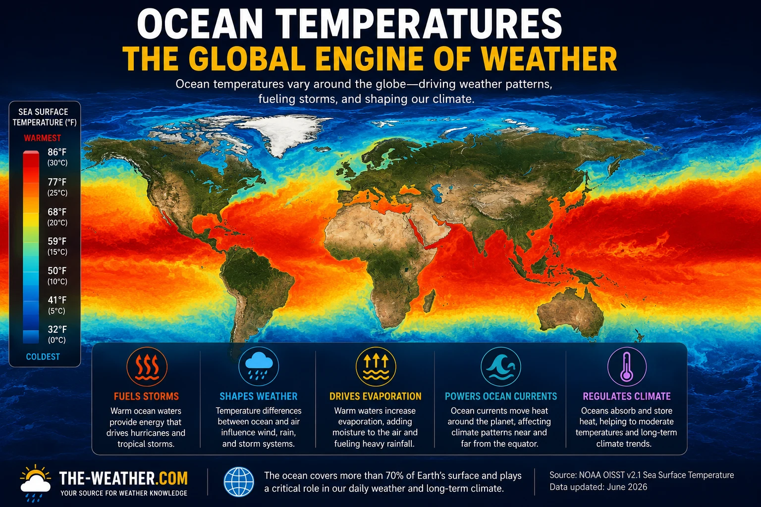
Geostationary satellites provide continuous imagery of cloud cover, sea surface temperatures, and atmospheric moisture. Polar-orbiting satellites sweep the entire globe twice daily, gathering data over oceans and remote regions beyond the reach of surface networks.
NEXRAD Doppler Radar Network
160 WSR-88D Doppler radar sites cover the entire continental US, scanning the atmosphere every 4 to 6 minutes. The network detects precipitation intensity, wind speed, storm cell movement, and rotation signatures that precede tornadoes.
Automated Surface Observing Stations
Over 900 ASOS stations at airports and key locations across the US measure temperature, dew point, wind, pressure, precipitation, and visibility every minute. This data feeds directly into NWS forecast models and aviation weather reports.
Radiosonde Weather Balloons
Every day at 00:00 and 12:00 UTC, NOAA launches weather balloons from 92 stations across North America. Each balloon carries a radiosonde that measures temperature, humidity, wind speed, and pressure from the surface up to 100,000 feet as it ascends.
Ocean Buoys and Ship Reports
A network of moored and drifting ocean buoys, combined with voluntary observing ships, provides real-time sea surface temperature, wave height, wind, and pressure data across the Atlantic, Pacific, and Gulf of Mexico.
Personal Weather Station Networks
NOAA supplements its official network with data from citizen observer programs like CoCoRaHS and Weather Underground, where thousands of home weather stations contribute hyperlocal precipitation and temperature readings that improve forecast precision at the neighborhood level.
Receive NOAA Data Directly at Home
You can tap into NOAA's data two ways. A home weather station lets you contribute your own readings to the NOAA-affiliated CoCoRaHS and Weather Underground networks. A NOAA weather alert radio receives official NWS warnings the moment they are issued, completely independent of the internet, even during power outages.
Related Weather Science Articles
Continue learning about NOAA, weather data, and how to use official resources effectively
NOAA Weather Data FAQ
Why is NOAA weather data important?
NOAA weather data is important because it underpins every weather forecast, storm warning, and climate projection in the United States. Every weather app, radar tool, and NOAA alert radio receives its data from NOAA's network of satellites, weather balloons, surface stations, and ocean buoys. Without NOAA data, no accurate short or long-range forecast would be possible.
What does NOAA use to collect weather data?
NOAA collects weather data from geostationary and polar-orbiting satellites, over 900 automated surface observing stations, 160 NEXRAD Doppler radar sites, weather balloons launched twice daily from 92 stations, ocean buoys, voluntary ship reports, and citizen science networks including CoCoRaHS and Weather Underground personal stations.
How does NOAA data affect everyday life?
NOAA data affects everyday life in many ways: it powers the weather forecast on your phone, triggers tornado and hurricane warnings via NOAA Weather Radio, informs flight routing to avoid turbulence, helps farmers plan irrigation and harvests, guides energy companies in predicting demand, and supports emergency managers in coordinating disaster response before storms hit.
Is NOAA weather data accurate?
Yes. NOAA's NWS 24-hour temperature forecasts have a mean absolute error of under 3 degrees Fahrenheit. Precipitation probability forecasts are well-calibrated. Modern NOAA numerical weather prediction models have improved 5-day forecast accuracy to match what 3-day forecasts achieved 20 years ago, driven by better satellite data, computing power, and data assimilation techniques.