
As an Amazon Associate, I earn from qualifying purchases.
In this article 10 sections
- What Is a Nimbostratus Cloud?
- How to Recognize Nimbostratus: Four Signs Together
- Mid-Level or Low? The Mix-Up Explained
- How Nimbostratus Forms
- The Warm Front Connection: Reading the Sky Hours Ahead
- Nimbostratus or Something Else?
- What a Nimbostratus Day Looks Like on Your Weather Station
- Nimbostratus FAQ
- Update Log
- Sources
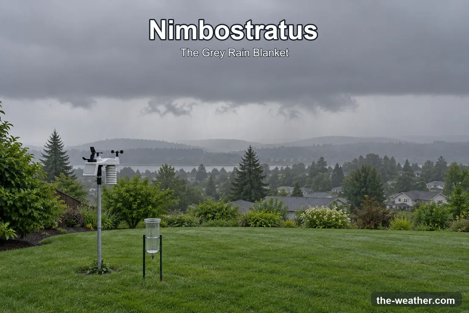
You know the day. No sun, no shapes in the sky, just one grey ceiling from horizon to horizon, and rain that simply does not stop. It is not dramatic. Nobody films it. But it is the cloud behind most long, soggy days, and it has a name: nimbostratus.
Short answer: nimbostratus is a thick, grey, often dark cloud layer that hides the sun completely and brings rain or snow that falls more or less continuously, often for hours. The World Meteorological Organization (WMO) puts it in the middle level of the sky, but its base can sink low as the rain goes on, which is why it is often mistaken for a low cloud. If you hear thunder or see lightning or hail, it is not nimbostratus: then the cloud is a cumulonimbus (WMO International Cloud Atlas).
Editorial Research
- Written by
- Lena Thornton, Weather Station Analyst & CWOP Contributor
- Based on
- The WMO International Cloud Atlas (definition, formation, look-alikes, height levels), NOAA JetStream and the National Weather Service office in Louisville, Kentucky
- Research last verified
- October 19, 2026
What Is a Nimbostratus Cloud?
The name says it all, once you know the Latin. Nimbus means rainy cloud and stratus comes from a verb meaning to spread out or cover with a layer. So nimbostratus is, quite literally, a layer of rain.
The official WMO definition describes it as a grey cloud layer, often dark, that looks blurry because rain or snow is falling from it more or less continuously. In most cases that rain or snow reaches the ground. And the layer is thick enough everywhere to blot out the sun.
That last part is the quickest test you have. If you can still see where the sun is, even as a pale disc, you are looking at something else.
How to Recognize Nimbostratus: Four Signs Together
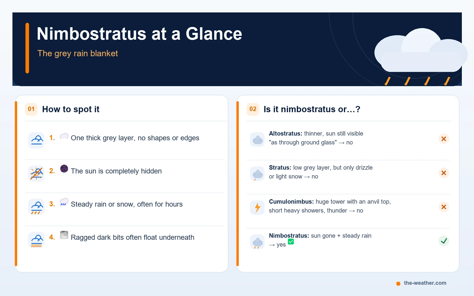
No single sign proves it on its own. A grey sky alone can be stratus or altostratus too. When you see all four together, nimbostratus is the best explanation.
- One thick grey layer. No puffs, no towers, no clear edges. The whole sky looks like one wet blanket.
- The sun is gone. Not dimmed, gone. You cannot tell where it is.
- Steady rain or snow. It keeps coming, often for hours, instead of stopping and starting.
- Ragged dark bits underneath. Small torn clouds often drift below the main layer. Meteorologists call them pannus.
A tip on that fourth point: the WMO warns observers not to confuse those ragged pieces with the real underside of the nimbostratus. They sit lower, move faster and can hide the actual cloud base completely. So if you are trying to judge how low the cloud is, you are often looking at the pannus, not at the nimbostratus itself.
Mid-Level or Low? The Mix-Up Explained
Here is something many cloud charts get wrong, including some older ones online. Nimbostratus is officially a middle-level cloud.
The WMO splits the sky into three levels. In temperate regions like most of the United States, these are roughly:
| Level | Typical height (temperate regions) | Cloud types |
|---|---|---|
| High | About 16,500 to 45,000 ft (5 to 13 km) | Cirrus, cirrocumulus, cirrostratus |
| Middle | About 6,500 to 23,000 ft (2 to 7 km) | Altocumulus, altostratus, nimbostratus |
| Low | From the ground to about 6,500 ft (2 km) | Stratus, stratocumulus, cumulus, cumulonimbus |
Source: WMO International Cloud Atlas, "Useful concepts", table of cloud levels (étages). The levels describe where a cloud usually sits, not how tall it is: cumulus and cumulonimbus usually have their base in the low level, but the WMO notes that their tops may reach into the middle and high levels. A big cumulonimbus can tower through all three.
So why does it so often get called a low cloud? Two reasons:
- It reaches into the other levels. The WMO says nimbostratus is almost always found in the middle level, but usually extends into the other two as well.
- Its base sinks as the rain goes on. NOAA explains that the cloud base lowers as precipitation continues, and says that because of this lowering base, nimbostratus is "often erroneously called a low-level cloud."
Add the pannus floating underneath, and from your backyard it really does look low. It is a bit like judging a tall building by its awning.
The WMO adds one more detail: nimbostratus usually has no clear underside at all. Sometimes you can see an apparent base, but that is often simply the level where falling snow melts into rain, because you can see less far through snow than through rain.
How Nimbostratus Forms
Nimbostratus rarely appears out of nowhere. According to the WMO, it usually develops from altostratus that keeps thickening while its base slowly lowers. The moment the layer becomes thick enough to hide the sun, it gets the name nimbostratus.
Less often, it grows from other clouds:
- rarely from a thickening layer of stratocumulus or altocumulus;
- sometimes from a cumulonimbus that spreads out;
- very rarely from rain-producing cumulus congestus (tall cumulus) that spreads out.
Inside, it is a mix of water droplets (sometimes supercooled, meaning still liquid below freezing), raindrops, snow crystals and snowflakes. Unlike most cloud types, the WMO does not split nimbostratus into species. It is just one big grey thing, and that is the whole point.
The Warm Front Connection: Reading the Sky Hours Ahead
This is where nimbostratus gets useful. It often sits at the end of a sky sequence you can watch develop. Think of it as a common pattern, not a guarantee: skies do not always follow the script, and a front can arrive with only part of this sequence. The National Weather Service office in Louisville describes it like this: as a warm front approaches, cirrus clouds tend to thicken into cirrostratus, which may thicken and lower into altostratus, stratus and even nimbostratus.
The same NWS page notes that altostratus itself usually does not produce significant rain at the surface. So the step from "the sun looks like it is behind frosted glass" to "where did the sun go?" is often the moment to bring the cushions in. More on this in our guide to reading the weather without a forecast.
Nimbostratus or Something Else?
Three clouds are easy to mix up with nimbostratus. Here is how the WMO tells them apart.
| Cloud | Sun visible? | Rain or snow | Other clue |
|---|---|---|---|
| Altostratus | Often yes, vaguely, "as through ground glass" | Usually little at the ground | Lighter grey, base higher than nimbostratus |
| Stratus | Sometimes, with a sharp outline | Weak drizzle, snow or snow grains | Usually forms without other clouds above it |
| Cumulonimbus | Not under its dark base | Showers of rain, snow or hail | Lightning, thunder or hail |
| Nimbostratus | No, never | Rain, snow or ice pellets, more or less continuous | Dark grey, sometimes seems lit from within |
Sources: WMO International Cloud Atlas, comparisons of nimbostratus with altostratus, stratus and cumulonimbus.
That "lit from within" clue is a nice one. The WMO notes that nimbostratus sometimes looks as if light comes from inside the cloud, something altostratus does not show.
The rule for cumulonimbus is simple and strict: the WMO says that if a cloud that looks like nimbostratus comes with lightning, thunder or hail, it is classified as cumulonimbus. A cumulonimbus can even spread out into nimbostratus later, so on a stormy day you may see both.
To see the difference, look at how a cumulonimbus is built. In this time-lapse, two strong updrafts grow into cumulonimbus clouds. Notice the towers and the sharp edges: that shape is exactly what a nimbostratus never has.
Video: Brayton Ewell on YouTube. This shows cumulonimbus, not nimbostratus: it is here as the contrast.
What a Nimbostratus Day Looks Like on Your Weather Station
If you have a home weather station, a nimbostratus day often leaves a recognizable pattern in your data. No magic numbers here, because every storm is different, and one thing up front: your data can support what you see in the sky, but it cannot name the cloud by itself.
- Rain gauge: the total climbs slowly and steadily over many hours. Compare that with a cumulonimbus, where the WMO describes the precipitation as showers: a big jump, then it stops. A gradual rise in rainfall totals is consistent with prolonged precipitation, but it cannot identify nimbostratus on its own. Check the cloud's appearance and the wider weather pattern as well.
- Solar sensor: very low for as long as the layer stays overhead, because the cloud is thick enough to hide the sun completely. Other thick overcast can do this too, so treat it as a supporting clue.
Want to get the most out of those readings? See how rainfall is measured and our rain gauge guide.
Nimbostratus FAQ
Is nimbostratus a low or a mid-level cloud?
Officially mid-level (WMO), but it usually reaches into the levels above and below, and its base sinks as the rain continues. That is why it is often called a low cloud.
Does nimbostratus bring thunderstorms?
No. Lightning, thunder or hail means the cloud is classified as cumulonimbus (WMO).
How long does rain from nimbostratus last?
The WMO describes its rain or snow as falling more or less continuously, and the University of Illinois Extension calls it "a long steady rain". How long exactly depends on the weather system that brings it, such as how fast a warm front moves.
What is the difference between nimbostratus and stratus?
Stratus gives at most weak drizzle, snow or snow grains. Nimbostratus gives real rain, snow or ice pellets and usually grows out of thickening altostratus.
What does the word nimbostratus mean?
It comes from Latin: nimbus means rainy cloud, and stratus comes from a verb meaning to spread out or cover with a layer (WMO International Cloud Atlas, etymology appendix). So it is a spread-out rain cloud.
Update Log
- October 19, 2026: Page published after an editorial review (recognition signs, weather station data and the warm front sequence worded as clues and common patterns, not proof). Definitions, height levels and comparisons checked against the WMO International Cloud Atlas, NOAA JetStream and the NWS Louisville cloud classification page.
Sources
- WMO International Cloud Atlas: Nimbostratus (definition, formation, physical constitution, look-alikes)
- WMO International Cloud Atlas: Useful concepts (cloud levels and heights)
- NOAA JetStream: Ten Basic Clouds
- University of Illinois Extension: Clouds (nimbostratus)
- National Weather Service Louisville: Cloud Classification
See also: 10 Types of Clouds · Nimbus Clouds: Nature's Rain Warning · Cloud Classification · Stratus Clouds