
We may earn a commission when you buy through links on this page, at no extra cost to you. Learn more
In this article 6 sections
Cumulonimbus Cloud: Vertical Development and Storm Characteristics
The cumulonimbus cloud is the most powerful formation in the atmosphere, representing the extreme energy of vertical development. As the primary engine for thunderstorms, it is a critical component of the types of clouds system. Identifying cumulonimbus is vital for severe weather preparedness, as these clouds are responsible for lightning, hail, and heavy precipitation.
Vertical Scale and the Anvil Structure
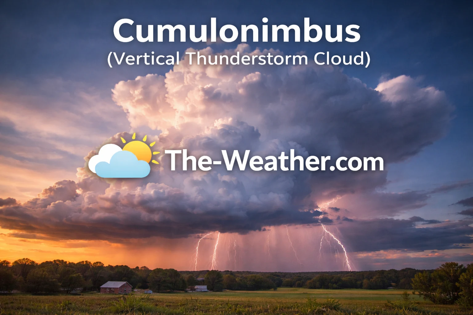
Cumulonimbus clouds tower high and produce lightning, hail, and intense storms.
Cumulonimbus clouds are unique due to their massive vertical extent. While they share a puffy origin with the low-level cumulus cloud, cumulonimbus formations grow violently upward until they reach the top of the troposphere. At these heights, the rising air hits a temperature barrier and spreads out horizontally, creating the iconic "anvil top." This fibrous upper section is composed of ice crystals, mirroring the texture of the high-altitude cirrus cloud.
Unlike the stable layers of stratocumulus cloud, a cumulonimbus is a site of intense atmospheric instability. The base is typically dark and low, often appearing heavy with moisture. From the ground, identifying the transition from a growing cumulus to a mature cumulonimbus involves looking for this darkening base and the subsequent wispy appearance of the cloud's summit. This growth indicates that the cloud has reached the "glaciation" stage, where water droplets turn to ice, a necessary step for lightning production.
Atmospheric Instability and Internal Turbulence
The formation of a cumulonimbus requires high levels of moisture and rapid convective lifting. This is often signaled earlier in the day by mid-level patches like the altocumulus cloud, which indicate instability in the middle atmosphere. Once the convection becomes deep enough, the cloud consumes the surrounding moisture to build a towering storm cell. Inside, violent updrafts and downdrafts create the friction necessary to generate static electricity and lightning.
While steady rain layers like altostratus cloud or the low-level nimbus clouds provide long-duration precipitation, cumulonimbus weather is characterized by its suddenness and intensity. These clouds are the only ones capable of producing hail, which forms as ice pellets are cycled repeatedly through the cloud's freezing layers by strong updrafts. The physical depth of these clouds can be so great that they create a complete blackout of sunlight directly beneath the storm core.
Recommended Books for Cloud Identification

If you want to go deeper than basic cloud charts, a dedicated cloud identification field guide can dramatically improve your understanding of altitude layers, cloud genera, and weather patterns.
Detailed photography and structured classifications make it easier to distinguish between similar formations such as cirrostratus cloud veils versus storm-bearing thunderheads. Many meteorology enthusiasts rely on these guides for accurate sky observation.
View Cloud Identification BooksDisclosure: As an Amazon Associate, we may earn from qualifying purchases at no extra cost to you.
Field guide
Read a Cumulonimbus by Its Parts
The World Meteorological Organization's International Cloud Atlas names the parts of a storm cloud. Each one tells you something different, and some mean you should act now.
| What you see | Official name | What it means for you |
|---|---|---|
| Towering cloud with a firm, cauliflower top and no fibrous edges | Cumulonimbus calvus | Young storm: the top has not yet turned to ice. Thunder, heavy rain and lightning can start any minute. |
| Top turns fuzzy, streaky or hair-like | Cumulonimbus capillatus | Mature storm: the upper part has frozen. Expect lightning, downpours and possibly hail. |
| Flat, spreading top like a blacksmith's anvil | Incus | The updraft has reached the top of the troposphere. The anvil spreads downwind with the high-altitude winds, and lightning can strike from it well ahead of the rain. |
| Pouches hanging under the anvil | Mamma | Sinking air under the anvil; often seen with strong storms, but not dangerous in itself. |
| Low, horizontal shelf or roll at the leading edge | Arcus (shelf cloud) | Gust front: strong, cold wind gusts and heavy rain arriving within minutes. Go inside. |
| Lowered, often rotating block under the rain-free base | Murus (wall cloud) | Where tornadoes can form in a supercell. Watch for persistent rotation and take shelter if it rotates. |
| Cone or funnel hanging from the base | Tuba (funnel cloud) | A tornado if it reaches the ground, even when the funnel looks incomplete. Take shelter now. |
A tip for sky watchers: a firm dome bubbling above the anvil (an overshooting top) means the updraft is so strong it punches into the stratosphere. Forecasters treat it as a sign of a severe storm.
Sources: WMO Cloud Atlas: calvus · capillatus · incus · arcus · murus · tuba · NOAA: what is a gust front?
Severe Weather and Frontal Signals
Advanced weather tracking relies on accurate identification of vertical giants.
From a forecasting perspective, the presence of cumulonimbus is an immediate signal for severe weather warnings. Unlike the steady overcast of cumulonimbus cloud identification, active storm tracking involves looking for "overshooting tops." These occur when the updraft is so powerful it punches through the flat anvil top and into the lower stratosphere, signaling an extremely intense storm capable of producing damaging winds or tornadoes.
Because these clouds represent such concentrated energy, they are a primary concern for aviation and maritime safety. While they can form in isolation on a hot afternoon, they often organize into "squall lines" along a cold front. This creates a wall of severe weather that can sweep across entire states. For anyone interested in meteorology, mastering the identification of cumulonimbus is the first step in understanding the sky's most dynamic and powerful energy cycles.
Common Questions (FAQ)
Can a cumulonimbus cloud form without rain?
In very dry environments, "dry thunderstorms" can occur where rain evaporates before hitting the ground (virga), but the cloud still produces lightning.
What does a dark base mean?
A very dark base indicates that the cloud is extremely thick and full of liquid water or hail, which blocks nearly all sunlight from passing through.