
Honey, we’ve all been there—stepping out for a morning coffee in the sunshine, only to be running for cover from a thunderstorm by lunchtime. Or wondering why your knees start aching right before it rains. The answer is almost always weather fronts. These are the invisible boundaries in the sky where contrasting air masses collide, and they drive significant shifts in temperature, pressure, and precipitation. In this guide, I’m going to walk you through exactly what these fronts are, how they form, and how you can spot them coming before the first drop falls.
Weather Fronts Cheat Sheet
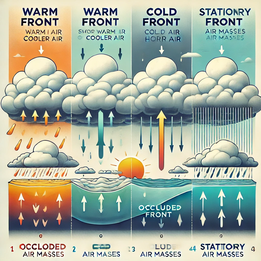
Blue triangles. Fast-moving. Brings heavy storms & sharp cooling.
Red semicircles. Slow-moving. Brings drizzle, fog & humidity.
Blue/Red mix. Stalls out. Causes days of relentless rain.
Purple line. Complex mix. Cold air overtakes warm air.
Pressure drops rapidly as a front approaches your home.
Winds often change direction completely after a front passes.
Weather fronts aren’t just random occurrences; they form when two air masses with distinct characteristics—such as temperature, humidity, and density—converge. Think of it like mixing oil and water; they don’t want to blend! These interactions create atmospheric boundaries that dictate the type and severity of weather changes.
The behavior of these air masses is influenced by major factors like jet streams, surface pressure systems, and seasonal variations. Meteorologists classify them into four main types based on how these air masses interact.
The Big Four: A Detailed Breakdown
| Front Type | Map Symbol | Typical Weather | The Aftermath |
|---|---|---|---|
| Cold Front | Blue line with triangles | Thunderstorms, heavy rain, hail. | Clear skies, cooler temps, lower humidity. |
| Warm Front | Red line with semicircles | Steady rain, drizzle, fog. | Warmer air, muggy/humid feel. |
| Stationary Front | Alternating Blue/Red | Days of clouds and steady rain. | Flooding risks if it stalls too long. |
| Occluded Front | Purple line | Complex mix of storms/wind. | Dry air usually follows eventually. |
1. Cold Fronts: Powerful Weather Changes
A cold front forms when a fast-moving, dense cold air mass displaces a warmer air mass. Because cold air is heavy, it acts like a bulldozer, wedging under the warm air and forcing it to rise rapidly.
As the front advances, it generates powerful gusts that can damage property or create dust storms.
From torrential downpours in summer to blizzards in winter, the lift creates heavy precipitation quickly.
The most recognizable sign. Temps can drop 20 degrees in just a few hours!
On the Map: Look for a blue line with triangular points indicating the direction of movement. Pressure usually drops as it approaches and rises sharply after it passes.
2. Warm Fronts: The Slow Movers
Occur when a warm air mass advances over a cooler, denser air mass. Since warm air is lighter, it slides up and over the cold air gradually. This creates a different kind of weather experience.
- Light, Prolonged Precipitation: Unlike the violent storms of a cold front, warm fronts bring steady rain, drizzle, or freezing rain that can last for days.
- Increased Cloud Cover: You’ll see a sequence of clouds, starting with high wispy cirrus and lowering to thick stratus clouds.
- Humidity Spike: Once the front passes, get ready for the mugginess! Dew points rise, and fog is very common.
3. Occluded Fronts: The Complex Mix
These develop when a cold front is moving so fast it overtakes a slower-moving warm front, pushing the warm air aloft entirely. This creates a “sandwich” of cold, warm, and cool air.
Why it matters: Occluded fronts are common in mature mid-latitude cyclones. They bring a messy mix of weather—extended periods of precipitation, shifting winds, and significant temperature swings.
4. Stationary Fronts: The “Stalled” Hazard
Sometimes, two air masses meet but neither has the strength to push the other out of the way. They enter a standoff.
Real-World Example: NASA’s View
Weather fronts aren’t just lines on a TV map; they are massive global events. NASA’s Earth Observatory recently captured a satellite image of a classic cold front sweeping across Europe.
What did the satellite see?
- Distinct Cloud Formations: A well-defined band of thick clouds along the leading edge, caused by the cold air forcing warm air upward.
- Sharp Temperature Contrasts: Ahead of the front, the land was warm and humid. Behind it? Significantly colder air.
- Wind Patterns: The imagery revealed wind speeds accelerating as the cold air undercut the warm air.
This is why I always tell you to look at the sky! Those satellite images prove that the cloud formations you see in your backyard are part of a massive system.
The Impact: Why Your Yard Changes
Weather fronts drive significant changes in daily life. Here is how they impact the three main pillars of your local weather:
Cold fronts cause temperatures to plummet, bringing crisp, dry air. Warm fronts introduce gradual warming, often making conditions feel heavy and oppressive before the rain starts.
Cold fronts dry things out after the storm. Warm fronts increase moisture, creating ideal conditions for fog and mold growth in the garden. Stationary fronts can lead to waterlogged lawns.
A fast-moving cold front generates sudden gusts and turbulence. This disrupts outdoor activities and aviation. Strong frontal winds can even lead to power outages.
How to Track Fronts Like a Pro
- Watch the Wind: Shifts in wind direction are the tell-tale sign. If the wind snaps from South to Northwest, a cold front just passed you.
- Monitor the Barometer: A falling barometer means a front is approaching. The faster it falls, the stronger the wind and storm will be.
- Check the “Feels Like”: Use a hygrometer. If humidity spikes suddenly, a warm front is likely pushing in moisture.
- Look at the Clouds: Cirrus clouds thickening into stratus? Warm front. Towering Cumulus clouds? Cold front.
- Stay Safe: Remember that cold fronts spawn tornadoes. Keep your weather alert radios charged.
Safety Warning: Severe Weather Risks
Honey, weather fronts are serious business. Cold fronts are the primary trigger for severe thunderstorms, hail, and tornadoes in the USA. When that cold air wedges under the warm air, the energy release can be explosive.
Meanwhile, Stationary fronts are sneaky. They don’t usually bring violent wind, but they bring volume. If a front stalls over your town, you can get a week’s worth of rain in two days, leading to flash floods. Always have a backup way to receive warnings.
Watch: Weather Fronts Explained

Frequently Asked Questions About Weather Fronts
What is a weather front?
A weather front is the boundary where two air masses with different temperatures, humidity levels, and atmospheric pressures meet. These interactions create shifting weather conditions, ranging from light drizzles to severe storms.
How can I tell if a weather front is approaching?
Look for changes in wind direction, temperature fluctuations, and cloud development. A falling barometer reading is also a sure sign. Cirrus clouds signal a warm front, while towering cumulonimbus clouds signal a cold front.
Why do cold fronts often bring storms?
Cold fronts force warm air to rise quickly. This rapid upward motion releases stored energy in the atmosphere, triggering intense thunderstorms, heavy rain, or hail. The more moisture in the air, the stronger the storm.
What happens after a warm front passes?
You will typically see a gradual temperature increase, cloud thinning (clearing skies), and increased humidity, which can make the air feel muggy or damp.
Are stationary fronts dangerous?
Yes, mostly due to flooding risks. Since they do not move, they cause prolonged rainfall over the same area. They can also cause dense fog that reduces visibility for drivers.
How do weather fronts affect temperature?
Cold fronts cause rapid drops in temperature (sometimes in hours). Warm fronts lead to gradual warming. Stationary fronts create a sharp contrast where one town might be cold and the next town over is warm!
Why are weather fronts important to meteorology?
They are crucial for predicting precipitation and severe weather warnings. Tracking them helps improve long-term climate models and provides accurate aviation and maritime forecasts.
Can weather fronts trigger tornadoes?
Yes. Tornadoes often develop along cold fronts, especially when warm, moist air meets strong upper-level winds (wind shear). Supercell thunderstorms frequently form along or ahead of these fronts.
How long do weather fronts last?
Cold fronts pass quickly (a few hours). Warm fronts move slowly (1-2 days). Stationary fronts can persist for days or even weeks. Occluded fronts usually last 1-3 days depending on the storm system.
Do weather fronts affect ocean conditions?
Absolutely. Strong cold fronts create rough seas and dangerous swells. Shifts in wind direction impact navigation, and low-pressure systems along fronts can intensify into hurricanes or nor’easters.
How do mountains affect weather fronts?
Mountains act as barriers. They force air to rise, causing “orographic precipitation” on the windward side. The leeward side (the back side) often remains dry due to the “rain shadow effect.”
Lena’s Backyard Wisdom
I recall one summer when a stationary front parked itself right over the Midwest. The weatherman kept promising sun “tomorrow,” but that front just wouldn’t budge! We had mold in the garden and the kids were going stir-crazy. That’s when I learned that “Stationary” basically means “Grab a good book, because this rain isn’t going anywhere.” Always check the map—if you see those alternating blue and red symbols, don’t plan a picnic!
More Weather Knowledge
Updates & Revisions
Last Updated: January 23, 2026. This article was updated to include the latest educational resources from the Met Office and NOAA regarding frontal boundary safety and satellite tracking.

Lead Reviewer at The-Weather.com
I’ve spent over a decade tracking storms and testing weather gear from my home in the Midwest. When I’m not analyzing barometric pressure trends, you can find me in my garden or teaching my grandkids how to read a rain gauge. I believe that local data is the best data! Read more about Lena.