
We may earn a commission when you buy through links on this page, at no extra cost to you. Learn more
In this article 5 sections
Stratocumulus Cloud Identification: Low-Level Puffy Layers and Characteristics
The stratocumulus cloud is a common low-level formation appearing as rounded, puffy masses organized into layers or patches. It is a vital component of the types of clouds classification, serving as a primary indicator of atmospheric stability in the lower troposphere. Identifying stratocumulus is key for distinguishing between fair-weather skies and impending overcast conditions.
Physical Appearance and the Fist Rule
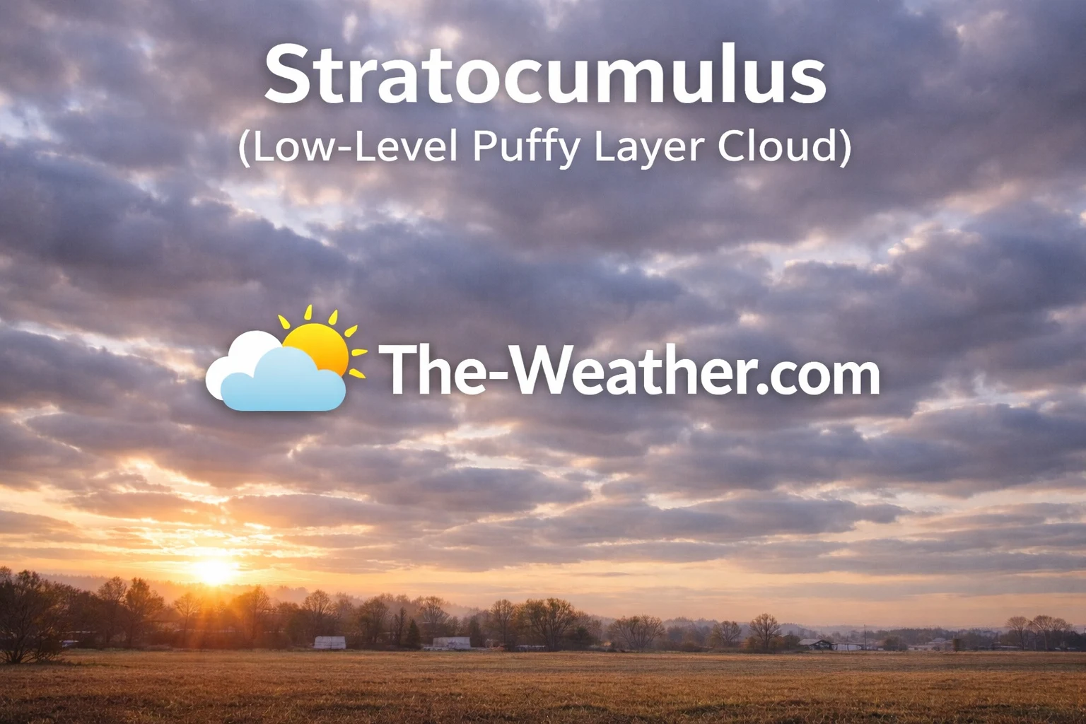
Stratocumulus clouds form low rolling patches with darker bases.
Stratocumulus clouds manifest as low, lumpy, and often gray patches that can cover vast portions of the sky. Because they exist at low altitudes, they are composed primarily of water droplets. A reliable identification cue for stratocumulus is the scale of its individual rounded masses. Meteorologists often use the "fist rule": if you hold your hand at arm's length toward the sky, an individual stratocumulus element will be roughly the size of your closed fist. This distinguishes them from the higher altocumulus cloud, whose elements are smaller (thumb-sized).
Unlike the high-altitude ice crystal formations like the cirrus cloud or the transparent cirrostratus cloud, stratocumulus is opaque and always features darker shading on its underside. This shading indicates the cloud's physical depth and its ability to absorb and scatter light. They often appear in organized rows or a "honeycomb" pattern, showing small gaps of blue sky between the masses, which helps separate them from the solid, featureless blankets of mid-level altostratus cloud.
Formation Physics and Atmospheric Stability
The formation of stratocumulus occurs when weak convective currents in the lower atmosphere are capped by a temperature inversion. This prevents the air from rising further, forcing the moisture to spread out into a localized layer. While they share the puffy appearance of the cumulus cloud, stratocumulus elements are connected or clustered in sheets rather than being isolated "cotton ball" masses. They represent a state of low-level moisture where there is not enough upward energy to create a massive storm like the cumulonimbus cloud.
In many maritime climates, stratocumulus fields can span thousands of miles across the oceans. On land, they are frequently observed in the wake of a cold front, as the lower atmosphere begins to stabilize but still contains lingering moisture. Unlike the rain-heavy nimbus clouds, stratocumulus rarely produces significant precipitation. At most, they may yield a light sprinkle or a few stray snow grains, making them a "non-active" cloud from a precipitation standpoint.
Recommended Books for Cloud Identification

If you want to go deeper than basic cloud charts, a dedicated cloud identification field guide can dramatically improve your understanding of altitude layers, cloud genera, and weather patterns.
Detailed photography and structured classifications make it easier to distinguish between similar formations such as stratocumulus vs. altocumulus or the various types of clouds. Many meteorology students rely on these guides for accurate sky observation.
View Cloud Identification BooksDisclosure: As an Amazon Associate, we may earn from qualifying purchases at no extra cost to you.
Weather Signals and Short-Term Prediction
Predicting a cloudy but dry day often involves identifying stratocumulus rolls.
From a forecasting perspective, stratocumulus is a signal of a relatively stable, moist boundary layer. Its appearance often indicates that the weather will remain overcast but mostly dry. If the rolls begin to flatten and merge into a solid, featureless sheet, the cloud is likely transitioning into stratus. Conversely, if the elements begin to grow taller and separate, it may signal an increase in vertical energy and a shift toward cumulus development. Identifying these subtle shifts is a key skill for short-term forecasting.
Because they exist at the boundary of the troposphere's lower layer, stratocumulus clouds are critical for Earth's temperature regulation. They reflect significant solar radiation back into space during the day, keeping the surface cooler. At night, they act as an insulating blanket, trapping heat near the ground. Whether you are an aviation enthusiast or a casual sky watcher, recognizing the difference between these low-level rolls and higher-level patches provides a clearer context for how moisture and energy are distributed in the atmosphere.
Common Questions (FAQ)
Can stratocumulus turn into a thunderstorm?
Not directly. They indicate stability. However, if the atmosphere becomes more unstable, stratocumulus may dissipate or evolve into cumulus, which could eventually grow into a cumulonimbus storm.
What is the best way to identify stratocumulus?
Look for low, gray, lumpy masses. Use the "fist rule" to confirm they are low-level; if an individual patch is roughly the size of your fist at arm's length, it is likely stratocumulus.