Altocumulus Cloud Identification: Mid-Level Patches and Weather Meanings
The altocumulus cloud is one of the most diverse and visually striking members of the types of clouds family. Situated in the middle levels of the troposphere, these clouds appear as organized patches or rolls, frequently referred to as “sheep clouds.” Identifying altocumulus is essential for detecting mid-level atmospheric instability and predicting potential thunderstorm development.
Physical Characteristics and the Thumb Rule
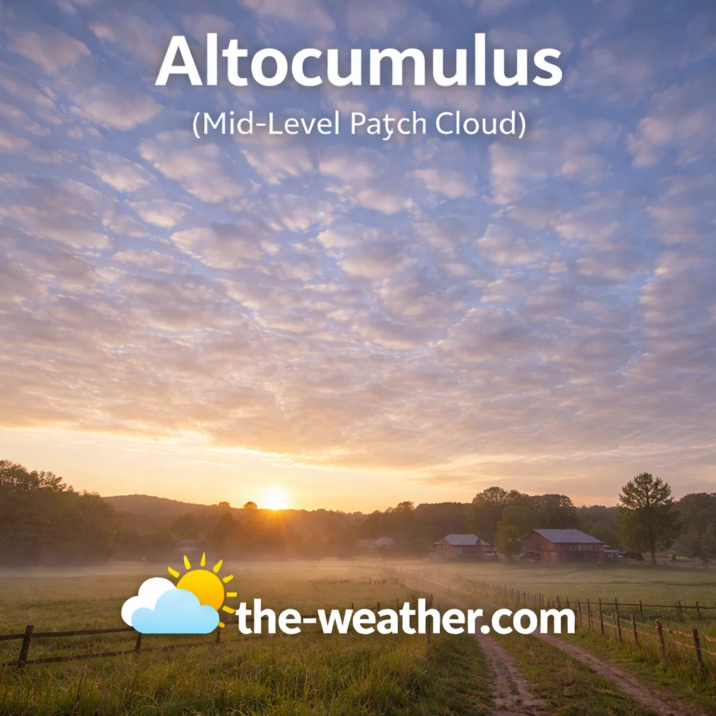
Altocumulus clouds often appear in rows of soft white or gray patches.
Altocumulus clouds typically manifest as gray or white sheets composed of individual rounded masses, rolls, or puffy patches. Because they exist at mid-level altitudes, they are composed primarily of water droplets, though ice crystals can form within them at higher, colder reaches. A defining identification cue for altocumulus is the size of its individual elements. Meteorologists use the “thumb rule” to distinguish them from other puffy layers: if you hold your hand at arm’s length toward the sky, an individual altocumulus cloudlet will be roughly the size of your thumb.
This distinguishes them from the higher cirrocumulus cloud, whose elements are much smaller (fingernail-sized), and the lower stratocumulus, whose elements are much larger (fist-sized). Altocumulus patches often show darker shading on their undersides, reflecting their increased depth compared to high-altitude ice clouds. When these clouds cover the entire sky in a rippling pattern, they create what is often called a “mackerel sky,” signaling that moisture is building in the middle atmosphere.
Convection Signals and the Castellanus Effect
Beyond their aesthetic appeal, altocumulus clouds provide vital data regarding atmospheric stability. A specific variety known as “altocumulus castellanus” features small, billowing towers that resemble the battlements of a castle. This formation occurs when moisture in the mid-layers is pushed upward by convective energy. If these castle-like towers are observed on a warm, humid morning, it is a very strong signal that the atmosphere is priming for severe weather, such as the cumulonimbus cloud, by the afternoon.
Unlike the flat, stable cirrostratus cloud, altocumulus represents a more dynamic and potentially turbulent environment. While they do not produce significant precipitation themselves, they often act as a bridge between fair-weather days and incoming storm systems. By monitoring how these patches thicken or merge into mid-level sheets like altostratus, sky watchers can track the progression of moisture as it prepares to descend into rain-bearing layers.
Recommended Books for Cloud Identification

If you want to go deeper than basic cloud charts, a dedicated cloud identification field guide can dramatically improve your understanding of altitude layers, cloud genera, and weather patterns.
Detailed photography and structured classifications make it easier to distinguish between similar formations such as altocumulus vs. cirrus clouds or the storm-bearing nimbus clouds. Many meteorology enthusiasts rely on these guides for accurate sky observation.
View Cloud Identification BooksDisclosure: As an Amazon Associate, we may earn from qualifying purchases at no extra cost to you.
Short-Term Prediction and Moisture Tracking
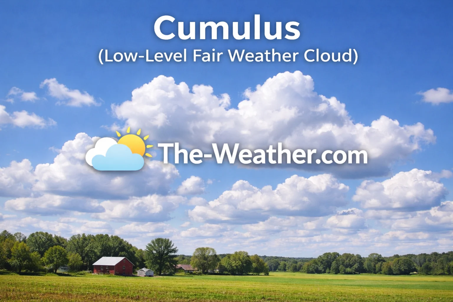
Altocumulus elements are smaller than low-level cumulus.
The transition of altocumulus is a valuable tool for short-term local forecasting. When these patches begin to cover the sky from the direction of the wind, it often indicates the approach of a front. If they are seen following a period of cirrus clouds, it confirms that moisture is descending and thickening. Conversely, if altocumulus patches begin to dissipate or “burn off,” it suggests that the mid-level moisture is evaporating and fair weather is likely to persist.
Because they are found in the middle atmosphere, altocumulus can also indicate the presence of wind shear or varying wind directions at different altitudes. This is particularly important for aviators and sailors who must understand the three-dimensional movement of the air. Whether they appear as “cloud streets” or scattered “cotton balls,” altocumulus clouds remain a primary focal point for identifying the dynamic energy that drives our daily weather changes.
Common Questions (FAQ)
Are altocumulus clouds dangerous?
Not directly. They do not produce severe weather themselves. However, their presence often signals instability that can lead to thunderstorms later in the day.
What is the difference between altocumulus and cumulus?
Altitude and scale. Altocumulus clouds are higher up and appear as small patches. The cumulus cloud is lower to the ground and appears as large, individual fluffy masses.