As an Amazon Associate, I earn from qualifying purchases.
In this article 9 sections
- What Happened: Genevieve's Explosive Development
- Intensification Timeline
- Why Did Genevieve Intensify So Quickly?
- Why the Eastern Pacific Rarely Produces Category 5 Storms
- Historical Comparison: Notable Eastern Pacific Category 5 Events
- Rapid Intensification Explained
- What Genevieve Teaches Us About Preparedness
- Sources
- Frequently Asked Questions

Weather Station Analyst and CWOP Contributor
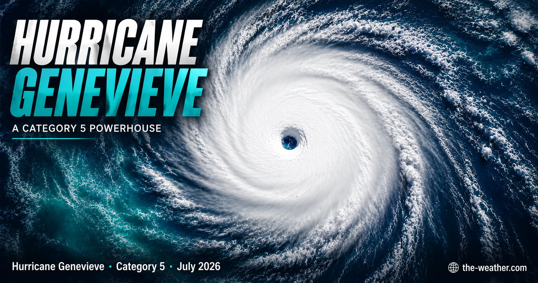
Hurricane Genevieve became the first Category 5 hurricane in the Eastern Pacific since 2024, reaching 160 mph sustained winds on July 28 2026 after intensifying from a named tropical storm in approximately 30 hours. The storm underwent textbook rapid intensification driven by exceptionally warm sea surface temperatures, low wind shear, and strong upper-level divergence. No direct land impact is forecast. This article explains what happened, why it happened, and what the science behind the event means for future hurricane seasons.
What Happened: Genevieve's Explosive Development
Hurricane Genevieve was named on Saturday July 25 2026 as it organised over the warm waters of the Eastern Pacific. Within hours of receiving a name, the storm began a rapid intensification sequence that would carry it from a modest tropical storm to the most powerful hurricane in the Eastern Pacific basin since 2024.
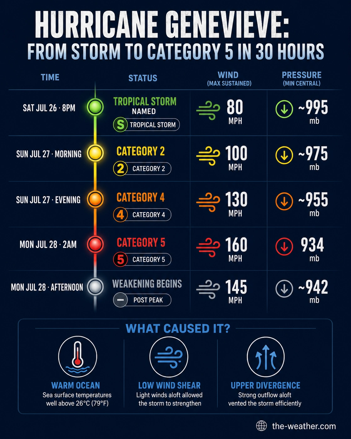
By Sunday evening Genevieve had already reached Category 4 strength. By 2 am Monday July 28, the National Hurricane Center confirmed Category 5 status with maximum sustained winds of 160 mph and a minimum central pressure of 934 millibars. That pressure reading, 79 mb below standard sea-level pressure of 1,013 mb, indicates an exceptionally intense and well-organised tropical cyclone.
Genevieve holds two records for the 2026 hurricane season: it is the first Category 5 storm in the Eastern Pacific since Hurricane Kristy in 2024, and it is the Northern Hemisphere's first major hurricane of the year across both the Atlantic and Eastern Pacific basins combined.
Although Genevieve is not expected to make landfall, the NHC has confirmed life-threatening surf and dangerous rip currents along the southwestern coast of Mexico and southern Baja California Peninsula. These hazards will persist and spread northward as the storm tracks northwest over coming days. Anyone near affected beaches should stay out of the water regardless of how the sky looks locally.
Intensification Timeline
The speed of Genevieve's development from a named storm to a Category 5 hurricane was exceptional even by the standards of Eastern Pacific rapid intensification events. Here is the sequence as confirmed by NHC advisories:
8 pm MST
Morning
Evening
2 am MST
Afternoon
Why Did Genevieve Intensify So Quickly?
Genevieve's rapid intensification was not unusual in its mechanism. It followed the same five-ingredient recipe as every other rapid intensification event. What made it exceptional was the simultaneous presence of all five at particularly high intensity over the Eastern Pacific in late July 2026.
1. Exceptionally warm sea surface temperatures
The Eastern Pacific south and southwest of Mexico recorded above-average sea surface temperatures (SSTs) through the 2026 season. Sea surface temperature is the primary fuel source for tropical cyclone intensification: the warmer the water, the more heat and moisture is available to drive the storm's engine. The warm water layer extended well below the surface, meaning that Genevieve's circulation did not stir up cooler water from depth quickly enough to significantly limit its intensification. This deep warm water pool provided sustained fuel for the strengthening storm throughout the rapid intensification period.
2. Low vertical wind shear
Vertical wind shear (the change in wind speed or direction with altitude) remained very low across the storm's environment during the intensification window. Without shear to tilt or disrupt the storm's vertical structure, Genevieve maintained the upright, symmetric organisation that allows maximum energy transfer from the ocean surface to the storm's circulation.
3. Strong upper-level divergence
The jet stream configuration over the Eastern Pacific created a pattern of strong upper-level divergence above the developing storm. This acted as an atmospheric exhaust fan, removing air from the top of the circulation faster than it could flow in at the bottom, causing the surface pressure to plunge rapidly. Per NHC advisory language, this was identified as the primary driver of the accelerating intensification rate.
4. High atmospheric moisture and organised core
High relative humidity in the mid-troposphere surrounding Genevieve prevented dry air intrusion that would otherwise weaken the convective bands. Combined with the rapidly organising eyewall visible in microwave satellite imagery, these conditions allowed the storm to convert available energy into wind speed at peak efficiency.
At 934 mb, Genevieve's minimum central pressure represents a drop of approximately 61 mb from its pressure at the time of naming. That works out to roughly 2 mb per hour sustained over the 30-hour intensification window, more than double the minimum threshold for rapid intensification as measured by pressure rather than wind speed. Coastal barometers and personal weather stations logged measurable swell-related pressure perturbations along the Mexican coast during peak intensity, a reminder that major hurricane pressure signatures are detectable by surface instruments well outside the storm's direct track.
For the complete science behind rapid intensification including all five ingredients, the forecasting challenges, and historical context, see our evergreen rapid intensification explainer. For the broader storm formation process, see our explosive cyclogenesis page.
Why the Eastern Pacific Rarely Produces Category 5 Storms
Genevieve's Category 5 status is notable partly because of how infrequently the Eastern Pacific produces storms of this intensity. While the basin is the world's most active hurricane basin per unit of ocean area, Category 5 events remain relatively rare compared to the Western North Pacific.
The Eastern Pacific's Category 5 storms typically require a narrow window of perfect conditions: sea surface temperatures must be warm enough to fuel rapid intensification, but the storms generally track northwest into progressively cooler water before they can sustain peak intensity for long. This is exactly the pattern Genevieve followed: it reached Category 5 at peak position then immediately began weakening as it moved into the cooler northeastern Pacific.
The sea surface temperature warming trend documented by NASA Earth Observatory across the Eastern Pacific since the mid-2010s has contributed to a higher frequency of rapid intensification events in the basin. The 2015 season, which produced Hurricane Patricia and its record 215 mph winds, is the benchmark against which all subsequent Eastern Pacific major hurricanes are measured.
Historical Comparison: Notable Eastern Pacific Category 5 Events
| Storm | Year | Peak winds | Min pressure | RI rate | Impact |
|---|---|---|---|---|---|
| Hurricane Patricia | 2015 | 215 mph | 872 mb | 105 mph / 24 hrs | Record Eastern Pacific basin, minimal land impact |
| Hurricane Otis | 2023 | 165 mph | 921 mb | Tropical storm to Cat 5 in 24 hrs | Struck Acapulco, catastrophic damage |
| Hurricane Kristy | 2024 | Cat 5 | n/a | Rapid | Open water, no land impact |
| Hurricane Genevieve | 2026 | 160 mph | 934 mb | 80 mph in ~30 hrs | Open water, surf/rip currents |
The Eastern Pacific hurricane season officially runs May 15 through November 30, but the most active period in terms of intense storms is July through September when sea surface temperatures peak and wind shear is typically at its seasonal minimum. Genevieve becoming the Northern Hemisphere's first major hurricane of 2026 by late July is not unusual. The Eastern Pacific historically leads the Atlantic in early-season major hurricane activity because of the warmer baseline water temperatures in that basin.
Rapid Intensification Explained
This video breaks down the atmospheric mechanics of rapid intensification using real storm examples, showing exactly how the five ingredients combine to produce explosive hurricane development like Genevieve's.
What Genevieve Teaches Us About Preparedness
Genevieve is a reminder that rapid intensification can transform a moderate storm into a catastrophic one within hours. For the 2026 hurricane season, the lesson is not that every storm will become Genevieve, but that every storm that looks manageable at Category 1 or 2 has the potential to intensify rapidly if it encounters favourable conditions. Preparation cannot wait for a storm to reach its peak.
- Act on tropical storm or Category 1 watches, not Category 3 or higher. If rapid intensification occurs, that watch upgrades faster than preparation can happen.
- Monitor local pressure trends. A sustained drop of more than 1 mb per hour at your location is a signal worth acting on regardless of what the official forecast shows.
- Have supplies assembled before storm season opens, not after a storm forms. The peak of Atlantic hurricane season, August through October, is approaching.
- Understand storm surge risk. Storm surge is the abnormal rise of water generated by a hurricane's winds pushing ocean water onshore. It is the leading cause of hurricane fatalities and is separate from rainfall flooding. If you live in a low-lying coastal area, know your surge zone and evacuation route before a storm is named.
- Know the difference between a watch and a warning. A hurricane watch means conditions are possible within 48 hours. A hurricane warning means conditions are expected within 36 hours. When a warning is issued for your area, preparation must already be complete. Rapid intensification events mean the warning can upgrade from watch to warning within hours.
For full hurricane season monitoring setups see our best weather stations for hurricane season, best emergency weather radios, and hurricane season preparation page. For background on how El Nino and La Nina affect hurricane seasons, see our full analysis.
Sources
- National Hurricane Center: official advisories for Hurricane Genevieve (EP072026)
- NOAA Atlantic Oceanographic and Meteorological Laboratory: rapid intensification research and SHIPS model
- NASA Earth Observatory: Eastern Pacific sea surface temperature trends
- American Meteorological Society Glossary: rapid intensification definition
- Zoom Earth: satellite and track data for Genevieve 2026
This article was published July 28 2026 based on NHC advisory data available at time of writing. Storm data will be updated as further advisories are issued. Always refer to the National Hurricane Center for official current information.
Frequently Asked Questions
No. The National Hurricane Center expects Genevieve to remain well out to sea on a course roughly parallel to the Mexican coast. No direct land impact is forecast. However, dangerous surf and life-threatening rip currents are affecting the southwestern coast of Mexico and the southern Baja California Peninsula, and these hazards will spread northward as the storm tracks northwest.
Hurricane Genevieve reached Category 5 status early Monday July 28 2026, with maximum sustained winds of 160 mph. It is the first Category 5 hurricane in the Eastern Pacific since Hurricane Kristy in 2024 and the Northern Hemisphere's first major hurricane of the 2026 season. The storm is now weakening as it moves into cooler waters northwest of its peak position.
As of July 28 2026, Genevieve was approximately 530 miles southwest of Manzanillo, Mexico, moving northwest at 13 mph. The storm is tracking over open water and is expected to weaken as it encounters cooler sea surface temperatures by midweek. Always check the National Hurricane Center at nhc.noaa.gov for the latest official position and intensity data.
Genevieve underwent rapid intensification due to five favourable conditions aligning simultaneously: very warm Eastern Pacific sea surface temperatures, low vertical wind shear, high mid-level atmospheric moisture, strong upper-level divergence acting as an atmospheric exhaust, and a well-organised central circulation. Winds increased from 80 mph to 160 mph in approximately 30 hours, qualifying as extreme rapid intensification by the NHC definition.
No direct hit is forecast. Genevieve is expected to remain far offshore and weaken as it moves northwest over cooler water. However, large swell generated by the storm is creating dangerous surf conditions along Southern California beaches. Stay out of the water near affected coastlines regardless of local sky conditions. Always check the latest NHC advisory for current track information.
Yes. Hurricane Genevieve became the Northern Hemisphere's first major hurricane of 2026 on July 27 to 28, reaching Category 5 with 160 mph winds in the Eastern Pacific. The Atlantic hurricane season peak runs August through October, so additional storms are expected across both basins. The 2026 Eastern Pacific season also featured Hurricane Fausto simultaneously active with Genevieve in late July.