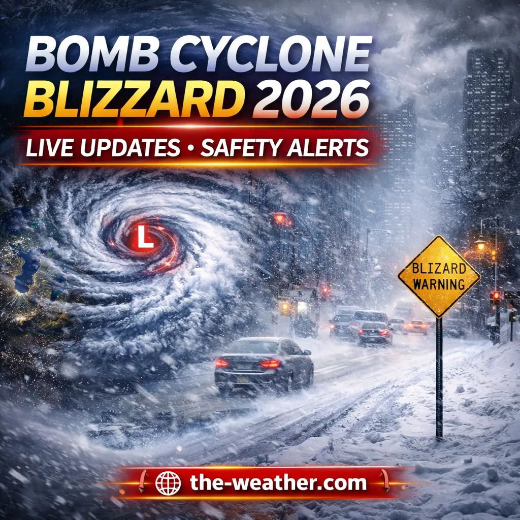
Bomb Cyclone Sweeps the Northeast: Current Outages and How to Stay Safe
Storm Safety at a Glance
- Status: Active Explosive Cyclogenesis
- Primary Threat: Whiteout blizzards, grid failures, coastal flooding
- Affected Region: I-95 Corridor (New York to Maine)
- Official Term: Bombogenesis (≥24 mb drop in 24h)
- Safety Directive: Shelter in place immediately, secure backup power
The bomb cyclone sweeping the Northeast currently represents a textbook case of explosive cyclogenesis. Meteorological data confirms the central barometric pressure of the system plummeted well beyond the required 24 millibars within a 24-hour period. This violent atmospheric vacuum is generating sustained hurricane-force wind shear, blinding whiteout conditions, and widespread infrastructural failure across the entire I-95 corridor. Emergency management protocols are active as the grid struggles under the weight of heavy, wet snow and structural icing.
We all watch the local news hoping the meteorologist is exaggerating. You look out your living room window on a Tuesday morning, see a few gentle flakes, and think you might just have a lovely work-from-home snow day. Then the wind hits. Within forty minutes, your driveway disappears, the sky turns into a solid wall of gray static, and the lights flicker out. You have just met a bomb cyclone face to face.
As of Tuesday, February 24, 2026, millions of residents are dealing with the harsh reality of these rapid-intensification storms. A massive low-pressure system parked off the New England coast has fully weaponized the Atlantic moisture feed. According to the National Oceanic and Atmospheric Administration (NOAA), this process of bombogenesis turns a standard winter precipitation event into a highly destructive kinetic threat. The National Weather Service (NWS) has blanketed the entire seaboard in severe weather alerts, and utility crews are fighting a losing battle against freezing lines.
If you want to understand how a mild rain shower off the coast of the Carolinas mutates into a grid-destroying monster by the time it reaches Boston, you have to monitor the physical pressure changes. I always tell my readers that the most reliable early warning system isn’t a colorful app on your smartphone. The best way to predict severe impacts is to master the identification of the types of clouds forming directly over your property. When you know the exact difference between harmless upper-level ice and a violently expanding vertical storm structure, you stop being a victim of the forecast and start preparing hours ahead of your neighbors.
Live Outage Tracking: The Reality of Grid Failures
The most devastating aspect of the 2026 bomb cyclone is not just the sheer volume of snow. The real danger comes from the physical weight of that precipitation combined with 70 mph wind gusts. Wet snow acts exactly like cement when it coats power lines and the branches of mature pine trees. When the extreme wind shear hits, thousands of trees simply snap under the strain, bringing down massive sections of the electrical grid in an instant.
For millions of residents currently shivering in the dark, the first priority is understanding the true scope of the failure. Local news stations often struggle to provide accurate numbers because the situation degrades so quickly on the ground. To get a clear picture of the disaster, you need to rely on aggregate data. The most effective tool for this is PowerOutage.us, a system that compiles real-time disconnected meter data from hundreds of utility providers across the country. By checking their live map, you can immediately see if your neighborhood is suffering a localized transformer blowout or if the entire regional substation has collapsed under the storm.
State governments in the Northeast have preemptively activated their emergency operations centers. However, utility crews are entirely grounded during the peak of explosive cyclogenesis. Boom trucks cannot safely operate when sustained winds exceed 40 mph, meaning the physical repairs will not even begin until the system moves out into the Atlantic Ocean. If your lights go out during the height of a weather bomb, you must be prepared to handle the extreme cold independently for a minimum of 48 to 72 hours.
The National Weather Service constantly updates its official forecast maps to show exactly where the heaviest bands of precipitation and the strongest pressure gradients are located. Watching these maps allows you to anticipate when the most dangerous wind shear will pass over your specific county, giving you a realistic timeline of when the damage phase will finally conclude.
Visualizing the Drop: A Step-by-Step Guide to Bombogenesis

If you look at the infographic provided, you can trace the exact timeline of the current 2026 bombogenesis event paralyzing the Atlantic coast. It visually explains the transition from a standard low-pressure center to a fully mature weather bomb. As the pressure plummets past the 24-millibar threshold, the system starts to look like a massive comma on satellite imagery. This specific “comma head” is where the most intense, blinding precipitation is located, wrapping completely around the center of the storm and dragging freezing air down to the surface.
To really comprehend the sheer volume of snow falling on the Northeast right now, you need to understand what clouds are made of. We are not talking about weightless mist. A single mature storm cloud holds millions of pounds of suspended liquid water and solid ice. When explosive cyclogenesis triggers, the atmosphere loses its ability to hold that immense weight gently, resulting in snowfall rates of three to four inches per hour.
The warning signs of this catastrophic failure always appear high above our heads hours before the first snowflake hits the pavement. The initial vanguard of the blizzard arrives as thin, icy cirrus clouds moving rapidly ahead of the warm front. These wisps tell meteorologists that the jet stream is perfectly aligned to act as an exhaust pipe, venting air away from the top of the storm to lower the surface pressure. As the vacuum intensifies, those high-altitude streaks merge into a milky cirrostratus cloud layer that often creates an optical halo around the winter sun.
Within hours, the light fades entirely. The sky fills with a thick, dreary altostratus cloud blanket, effectively signaling that the point of no return has passed. Eventually, this gives way to ragged, wind-torn stratocumulus clouds carrying the very first waves of heavy snow into coastal cities.
Standby Power Systems
Bomb cyclones frequently snap utility poles across entire counties. Compare the highest-rated dual-fuel portable generators to keep essential appliances running during multiday outages.
Roofing Reinforcements
Hurricane-force winter winds exploit weak shingles. Explore architectural-grade roofing materials and structural tie-downs designed to withstand extreme cyclonic shear.
Hyper-Local Forecasting
Stop relying on delayed airport data. Install professional-grade backyard weather stations equipped with precision barometers to track pressure plunges in real-time.
Cold Weather Gear
Surviving a multiday grid failure requires serious insulation. Stock up on extreme-temperature sleeping bags, base layers, and battery-powered heated apparel for the family.
Live Coverage: Tracking the Historic 2026 Blizzard
When explosive cyclogenesis peaks, visual confirmation is often the only way to truly grasp the sheer scale of the devastation. The rapid accumulation of heavy, wet snow, combined with sustained hurricane-force wind shear, turns familiar interstates into impassable ice trenches in a matter of minutes. Emergency management directors across the I-95 corridor have explicitly warned residents that rescue operations are completely suspended during the height of the whiteout.
Watching the meteorological data translate into physical destruction provides a stark reminder of why sheltering in place is not a suggestion, but a strict survival mandate. Below is the real-time reporting from the field as the barometric pressure continues its historic plunge.

Coverage Tracking Historic Blizzard Of 2026, Bomb Cyclone Paralyzing Northeast | FOX Weather
Understanding the Threat: Bomb Cyclone vs. Nor’easter
Because the wind speeds and coastal flooding closely mimic summer disasters, anxious residents constantly ask meteorologists if a winter weather bomb is simply a snowy hurricane. The answer is a firm no. They share similar destructive capabilities regarding infrastructure, but their thermodynamic makeup is entirely different. A hurricane is a warm-core system that requires bathwater-hot ocean temperatures to survive, possessing a well-defined eye and absolutely no weather fronts.
The bomb cyclone blizzard of 2026 is a cold-core system. It thrives on the violent, kinetic collision of warm and freezing air masses. It features distinct cold and warm fronts sweeping outward across hundreds of miles. To help clarify the exact threat level you are facing, we have broken down the precise scientific differences between these severe weather events.

Bomb Cyclone vs Other Storms: Quick Comparison
| Storm Type | Formation Trigger | Pressure Drop Rule | Typical Wind Shear | Key Difference |
|---|---|---|---|---|
| Bomb Cyclone (Explosive Cyclogenesis) | Mid-latitude clash of extreme cold and warm ocean air | ≥24 millibars strictly within 24 hours | Up to hurricane-force (74–95+ mph) | Rapid intensification creates a massive vacuum; “weather bomb” |
| Standard Nor’easter | Mid-latitude coastal development | Gradual, fluctuating decline | Strong gales (40–60 mph) | Slower strengthening; highly predictable timeline |
| Hurricane (Tropical Cyclone) | Deep tropical oceans, warm water fuel only | Rapid, but not the defining diagnostic rule | 74 to 150+ mph | Warm-core system, absolutely no attached weather fronts |
How to Prepare for a Bomb Cyclone: Securing Your Home
As a weather station specialist, my primary objective is moving people away from passive observation and toward active preparation. When you search for how to prepare for a bomb cyclone, you will find countless lists suggesting bread and milk. That is woefully inadequate for an event that actively destroys municipal infrastructure. The official guidelines established by FEMA and published on Ready.gov mandate that families maintain a minimum of 72 hours of total self-sufficiency. During a historic blizzard, that 72-hour window can easily stretch into a full week.
Your smartphone is a secondary communication device during explosive cyclogenesis. Cellular towers operate on battery backups that drain rapidly in freezing temperatures, and high winds frequently misalign the transmitter dishes. When the mobile networks fail, you are entirely disconnected from emergency broadcast alerts. You must have a localized, dedicated hardware solution to track the storm’s path and monitor evacuation or shelter-in-place orders.
Frequently Asked Questions: Bomb Cyclone Safety
What defines the Bomb Cyclone Blizzard of 2026?
The 2026 event is defined by explosive cyclogenesis, where atmospheric pressure drops at least 24 millibars within 24 hours, producing hurricane-force winds and extreme snowfall across the Northeast.
How do I track power outages during a winter storm?
Track live grid failures using state utility websites or national aggregation tools such as PowerOutage.us, which compile real-time disconnected meter data across the United States.
What should go in a winter survival kit?
A winter emergency kit should include a battery-powered NOAA weather radio, three days of non-perishable food, one gallon of water per person per day, thermal blankets, flashlights, and backup power banks.
How does a bomb cyclone differ from a normal nor’easter?
Both are mid-latitude winter storms, but a bomb cyclone intensifies rapidly due to a sharp pressure drop of at least 24 millibars in 24 hours, resulting in stronger winds and faster development than a standard nor’easter.
Why is travel dangerous during explosive cyclogenesis?
The intense pressure gradient creates whiteout conditions, rapidly accumulating snow, falling trees, and dangerous wind gusts that can strand vehicles and delay emergency response.
* As an Amazon Associate, The Weather earns from qualifying purchases.
Best Emergency Weather Radios for Bomb Cyclone Power Outages
When the power grid fails, cell towers often lose backup within hours. A NOAA weather radio continues receiving National Weather Service alerts even when mobile networks collapse. These are the most reliable models for multi-day winter outages.

🥇 Best Overall for Home Safety
Midland WR120B NOAA Emergency Weather Alert Radio
- S.A.M.E. localized county alerts
- 90dB emergency siren
- Battery backup during outages
- Trusted nationwide standard
🥈 Best Portable & Budget Option
RunningSnail 2000mAh Emergency Hand Crank NOAA Radio
- Hand crank + solar charging
- USB phone charging
- LED flashlight + SOS alarm
- Ideal for vehicles & apartments
🥉 Best High-Capacity for Multi-Day Outages
FosPower NOAA Emergency Weather Radio (7400mWh)
- Large 7400mWh battery
- Solar + USB + hand crank charging
- AM/FM + NOAA alerts
- Best for extended blackouts
During explosive cyclogenesis events, preparation must happen before infrastructure collapses. A dedicated NOAA weather radio provides direct National Weather Service alerts specific to your county — without relying on internet or cell networks.
📝 The Survival Cheat Sheet: Immediate Actions
Before you dismiss the severity of this bomb cyclone, memorize these critical safety protocols:
- ✅ Secure the Perimeter: High-velocity wind shear arrives before the heaviest snow. Anchor or store all patio furniture, grills, and trash cans immediately.
- ✅ Charge Everything: Do not wait for the lights to flicker. Keep all mobile devices, power banks, and rechargeable lanterns plugged in until the moment the grid fails.
- ✅ Establish a Safe Room: If your local weather radio issues an extreme wind warning, treat it like a hurricane. Move your family away from large exterior windows to an interior hallway or basement.
- ✅ Conserve Heat: If you lose power, close all blinds and curtains to create a dead-air insulation barrier against the freezing glass. Gather the family into a single, small room to maximize body heat.
Sources & Verified Meteorological Data
The data, tracking protocols, and safety recommendations provided in this report are sourced directly from the National Oceanic and Atmospheric Administration (NOAA) definitions of explosive cyclogenesis, the National Weather Service (NWS) live forecast modeling, and the official disaster preparedness directives established by FEMA via Ready.gov. Real-time infrastructure failure metrics are provided by independent aggregation at PowerOutage.us.
Last Updated: